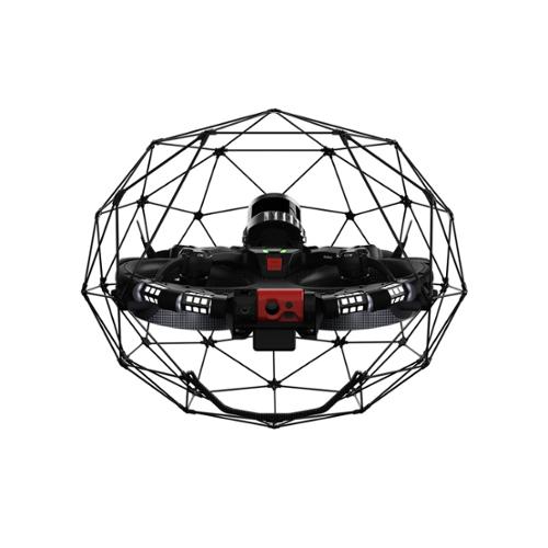
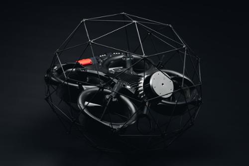
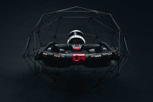

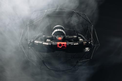


The Elios 3 Surveying Light package is a streamlined solution designed for efficient indoor inspections and mapping. At its core is the Elios 3 drone, equipped with a LiDAR payload that enables precise centimeter accurate scans for data collection and advanced 3D mapping capabilities. With its collision-resilient design and SLAM-based stabilization, the Elios 3 drone offers exceptional stability and locational awareness, even in complex industrial settings. The package includes essential components such as three Elios batteries, two chargers, and a tablet for the Ground Control Station, ensuring extended operational time and seamless control.
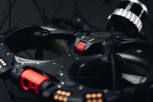
Equipped with the Ouster OS0-128 Rev 7 LiDAR sensor, it creates high-density point cloud maps, which provide real-time 3D views of the drone's trajectory and environment. This empowers users to digitize inaccessible areas with ease and assess inspection coverage instantly. The modular payload bay supports auxiliary payloads, making the Elios 3 a versatile and future-proof inspection tool. Designed for tough work environments, the drone's unique reversing motors and signature cage ensure resilience, allowing it to recover from flipping upside-down without the fear of crashing.
Comprehensive data is key to supporting operational decisions. Yet many hazardous environments are beyond the reach of existing data capture technologies.
Flyability's Surveying Payload turns the Elios 3 into a flying mobile scanner that can fit through openings as small as 50x50cm, and create high resolution scans beyond line of sight, allowing industry professionals to provide rapid insights that are not accessible with traditional tools or other UAV technologies.
Survey-grade accuracy |
| The high-resolution Ouster OS0-128 Rev 7 LiDAR sensor in combination with the world's leading FARO Connect SLAM algorithm create incredibly accurate 3D maps and digital twins of the most inaccessible spaces with centimeter precision - for accurate measurements and greater insights. |
Stunning point cloudsCapture rich, detailed point clouds of the most complex indoors, operating from a safe location. With Elios 3’s Surveying Payload you can effortlessly create comprehensive visual representations of challenging indoor spaces, allowing for precise mapping and analysis. |
|
Precision 1σ +/- 6 mm |
Precision 2σ +/- 12 mm |
Photon Sensitivity 10 x |
With its small form factor, the Elios 3 and the Surveying Payload can fit through openings as small as 50x50cm. It has a fixed cage that physically protects the hardware and a patented combination of flight controller and motor design that allows the drone to recover flight stability after a collision. This enables the drone to navigate through the most complex environments to capture high resolution scans where no other technology can.
The Elios 3 Surveying Payload is bundled with FARO Connect, a powerful software solution to process and manage the Elios 3’s LiDAR data. Powered by the world’s leading SLAM algorithm, FARO Connect converts data from the Elios 3 into highly accurate point clouds and provides a range of SLAM presets, optimized for the most common data capture scenarios of the Elios 3. Features include:
Data alignmentCombine multiple point clouds to produce one single scan using reflective targets. |
GeoreferencingAutomatically georeference point clouds using reflective targets. |
Point cloud filteringRefine Elios 3 3D models with various filters including outlier removal, surface noise reduction, and removal of unwanted points. |
Easy exportOutput the processed point cloud data to your required file type: LAZ, LAS, PLY, TXT, and E57. |
Elios 3 Survey Light Features:
Qty 1- Elios 3 Drone
Qty 1- Ouster OS0-128 Rev 7 LiDAR Scanner
Qty 3- Elios Batteries
Qty 2- Elios Battery Chargers
Qty 1- Tablet of the Ground Control Station
Qty 1- 1.8m USB Cable, Remote Controller Charger with Adapters, USB Power Plug
Qty 1- Smart Battery Guidelines and Original Instructions Documents
Qty 1- Toolbox
Qty 1- Remote Controller of the Ground Control Station
Qty 1- Adjustable Harness for the Remote Controller with Mounts and Screws
Qty 3- Propeller Packs with M5 Nuts (3x pack of 4x propellers)
Set of spare cage elements, which includes different types:
Qty 1- Cage Top Hexagon A
Qty 2- Cage Top Pentagon B
Qty 2- Cage Bottom Pentagon C
Qty 2- Cage Bottom Hexagon D
Qty 1- Cage Triangle
Qty 1- Transport case